Tags

Views
96
Downloads
0
File Size
7.52 MB
Date Added
Apr 26, 2024
Description
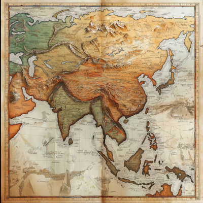
This image depicts a detailed and stylized topographic map of South Asia, illustrating the distinctive physical geography of the region. Notably, it captures the rugged terrain of the Himalayas to the north, the expansive Indo-Gangetic Plain extending across much of the middle, and the peninsular region of India extending into the Indian Ocean. The map also highlights neighboring regions including parts of China and the surrounding seas. Coastal contours and smaller island formations around this subcontinent are distinctly visualized. The visual style uses shading and color gradients to emphasize the varied elevations, with higher regions shaded in earthy browns and lower areas in greens and blues, suggesting elevation and depth respectively. This artistic rendering could be useful for educational or illustrative purposes, providing a vivid depiction of the region's topographical diversity.


